This attractive 2006 map from National Geographic is widely available and often seen in the hands of first time visitors. However, gorge enthusiasts do not like this map. Their contention is that it contains potentially serious errors that get people lost. These errors are discussed in detail below.
It’s unfortunate that the NatGeo map has such problems, because otherwise it’s a very nice map and one of the few you can buy in a large, folding format. The publisher claims to make regular revisions, so perhaps some future edition will be an admirable product. Until that time, buyer beware. Preview it before purchase on the NatGeo website.
Errata
Summary
Perhaps the underlying concern about the NatGeo map is that it gives the impression that navigation in the gorge is simple. Whether or not the errors it contains will affect your particular itinerary, you will find that a 1:65000-scale map omitting the many unofficial trails in the gorge can quickly get you lost.
That said, the map does contain numerous errors with the potential to create a really bad experience. Review them below to see if your plans involve these critical errata.
Trail Difficulty Ratings
The map contains a table giving a difficulty rating for each trail. Many people may never even see this fineprint, but if you do, and you plan your hike around it, you’re in for disappointment. Practically every trail is rated “moderate”, robbing the rating system of any value.
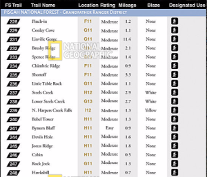
The fact is that many of these “moderate” trails are extremely difficult. Pinch-in Trail is notorious. Cabin is just as bad, though mercifully shorter. Cambric (misspelled “Chimbric” in the table) is such a mess that it’s been removed from the official trail system. Little Table Rock, Jonas Ridge, Brushy Ridge, and Hawksbill all have bad sections that are far from “moderate”.
This table is so misleading that it’s dangerous.
Trail Labels
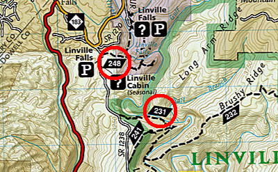
There are two trail labeling issues, both in the northwest corner of the gorge, and both popular trails for first time visitors. First, the extremely popular Linville Falls trail is labeled “248”, Hawksbill. Second, the Pine Gap trail just south of Linville Falls is labeled “231”, the Linville Gorge Trail. Signage at both of these trailheads contradicts the NatGeo map, potentially leading to confusion.
Hawksbill & Jonas Ridge
Even if you do manage to find the correct Hawksbill trailhead, you’re in for more potential confusion.
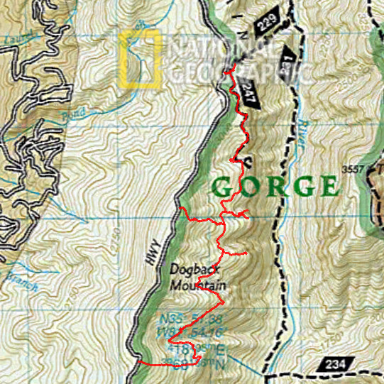
The route shown for the Hawksbill Trail is completely fictional. The origin of this fiction is uncertain, but it appears to have been pulled from the U.S. Forest Service records, which are likewise in error for this particular trail. Additionally, this trail was recently rerouted due to erosion issues, so the NatGeo map is behind the times.
Incorrect illustration of the Hawksbill route would be no big deal on a map of this scale, so long as it more or less connected the dots: trailhead and summit. However, the map simultaneously omits the southern half of the Jonas Ridge Trail (#245 on the map). The Jonas Ridge Trail intersects the newly rerouted Hawksbill Trail in a way that is unfortunately confusing. Lots of people get mixed up at that intersection, to such an extent that local rescue agencies have been unnecessarily burdened. This map’s omission of this critical information is sure to make the situation worse.
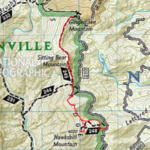
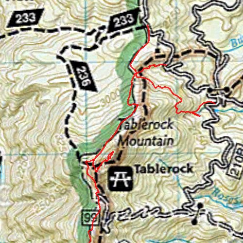
Table Rock Summit and Mountains-to-Sea
The NatGeo map completely misrepresents access to the extremely popular Table Rock Summit Trail, giving the impression that one might hike up and over the top of Table Rock Mountain by following the Mountains-to-Sea Trail.
MST’s intersection with Table Rock Road (210) is more or less correct, but this is an example of how oversimplification can lead to trouble. MST has two alternate approaches to the road, and this information has been omitted.
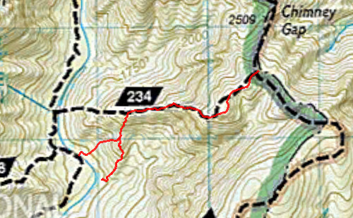
Cambric
The NatGeo’s portrayal of the western end of Cambric Trail is not in keeping with the ground truth. There are several potential final descents for Cambric, and it would be a shame to find oneself not only exhausted by this difficult trail, but also hopelessly lost deep in the gorge.
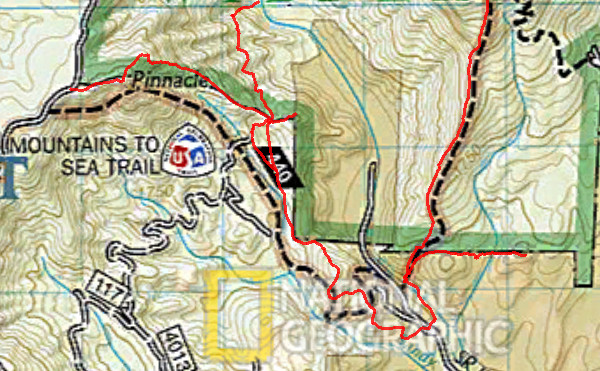
Mountains-to-Sea
In addition to the MST confusion at Table Rock, there is potential trouble in the south end of the gorge as well. The route is mangled and misleading. A number of access trails are omitted by the map’s oversimplification.
Rock Jock
Only the northern end of Rock Jock (#247) is portrayed by NatGeo. The majority of the trail, and also a number of side trails, are omitted.