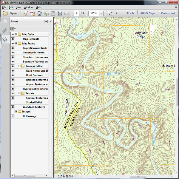
The USGS topo maps covering Linville Gorge were last updated in 2013. These are the classic 7.5′ topos that have long been the standard for orienteering, and are still used extensively by the North Carolina Outward Bound School at Table Rock.
USGS Maps, Imagery, and Publications is generally where you would go to download free topographic maps, but direct links to the maps you probably want are listed below, including links to purchase prints from the USGS Store.
Linville Falls is the quadrangle covering the north half of the gorge.
PDF of 2013 edition – PDF of 2011 edition – 2013 Print from USGS
Ashford covers the south half.
PDF of 2013 edition – PDF of 2011 edition – 2013 Print from USGS
Chestnut Mountain covers the area east of Linville Falls. You may not need this one.
PDF of 2013 edition – PDF of 2011 edition – 2013 Print from USGS
Oak Hill lies east of Ashford. You may want this one if exploring the Shortoff area.
PDF of 2013 edition – PDF of 2011 edition – 2013 Print from USGS
In recent years the PDF editions of this topo series have become increasingly feature rich, with over a dozen layers that can be enabled/disabled in Adobe Reader. Note that current (2013) editions do not include trail information, though some older maps in the USGS Historical Topographic Map Collection do. Trail information of dubious quality is available in the special Forest Service edition of the 2013 USGS topos.

Note the many layers available in the sidebar.
