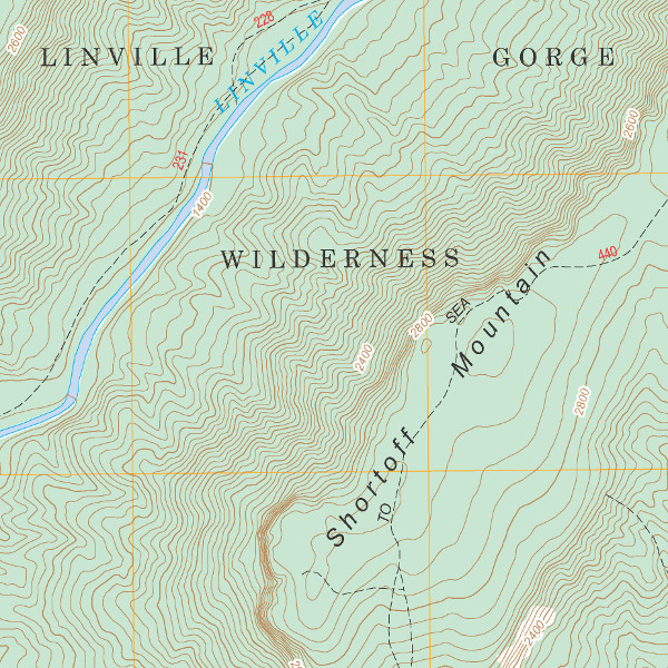
The FSTopo maps from the FSGeodata Clearinghouse add Forest Service information to the US Geological Survey 7.5′ series. That includes trails, official and some unofficial. Trail placement isn’t always accurate. Some appear to be penciled in from the age before GPS. Others are indicated in routes now abandoned or replaced. However, these maps give insight into official thinking toward the gorge trail system.

The Forest Service appears candid about the maps’ shortcomings, and committed to ongoing improvements. From the FSTopo site: “Over time, FSTopo will include more Forest Service authoritative data that are contributed by FS field unit staff and FSTopo products will increasingly reflect current, on-the-ground conditions.”
Here are the direct links for free download of the quadrangles that cover the Linville Gorge:
Linville Falls: PDF and GeoTiff (gorge north)
Ashford: PDF and GeoTiff (gorge south)
While prints of the US Geological Survey maps may be easier to find, the Forest Service prints are reported to be available from some Forest Service offices and retail outlets.

The FSGeodata Clearinghouse offers more than just topo maps. A variety of downloadable data is available. For example, you can get a wide variety of boundary datasets for USFS lands.
